Vibrant Planet develops tools for land management planning and monitoring to help increase the resilience of forests around the world. Our work with Vibrant Planet is producing data to support these tools.
A multidisciplinary team approach
We are working directly as part of the Vibrant Planet team, contributing expertise in machine learning, forest ecology, remote sensing data (information collected from satellites, drones or aircraft) analysis and project management.
The relationship between forests and fires has changed
Fires are a natural part of the growth and renewal of some forest ecosystems, such as in Australia, the western United States and Mediterranean Europe. In these places, the landscape usually includes patches of burned forest and scorched trees.
Urban and rural development in the last 100 years, however, has led to fires being suppressed to protect houses, infrastructure, and commercial timber. This suppression has reduced the diversity of plant species in forests and caused readily burnable fuels like grass, shrubs and fallen leaves to build up under larger trees. It has also prevented the natural cycling of nutrients and carbon in the ecosystems.
All of these changes have caused forests to become hazardously overgrown and unresilient, with too many trees competing for resources. Add in the drying effects of climate change that create tinder-dry fuels and ‘normal’ wildfires become megafires.
Catastrophic megafires
Today’s fires can be catastrophic with trees being destroyed across large areas rather than just being scorched. The Caldor fire in 2021 for example, covered an area of 90,000 hectares and burned for 2 months.
Not only is biodiversity lost, but water supplies become less reliable because of the damage to water infrastructure and watersheds. Megafires can cause landslides into water reservoirs, which then require expensive dredging to restore their function. The fires also release massive amounts of carbon into the atmosphere and become unstoppable as they burn into communities.
Land Tender is a decision-making tool
Thinning trees and controlled fires are effective ways to reduce the fuel load in a forest. They are commonly used by forest managers to increase the resilience of a forest.
Land Tender is a collaborative planning tool developed by Vibrant Planet. It helps forest managers understand the risk of fire to communities and ecosystems and decide on the best areas to carry out forest management. Launched in September 2021, Land Tender is already being used in many large, high profile landscapes in California.
Developments in Land Tender will allow managers to compare what actually happened in a fire with what was predicted, and monitor how quickly an area recovers. It will also help the development of strategies to restore forests after fires.
Mapping all the trees
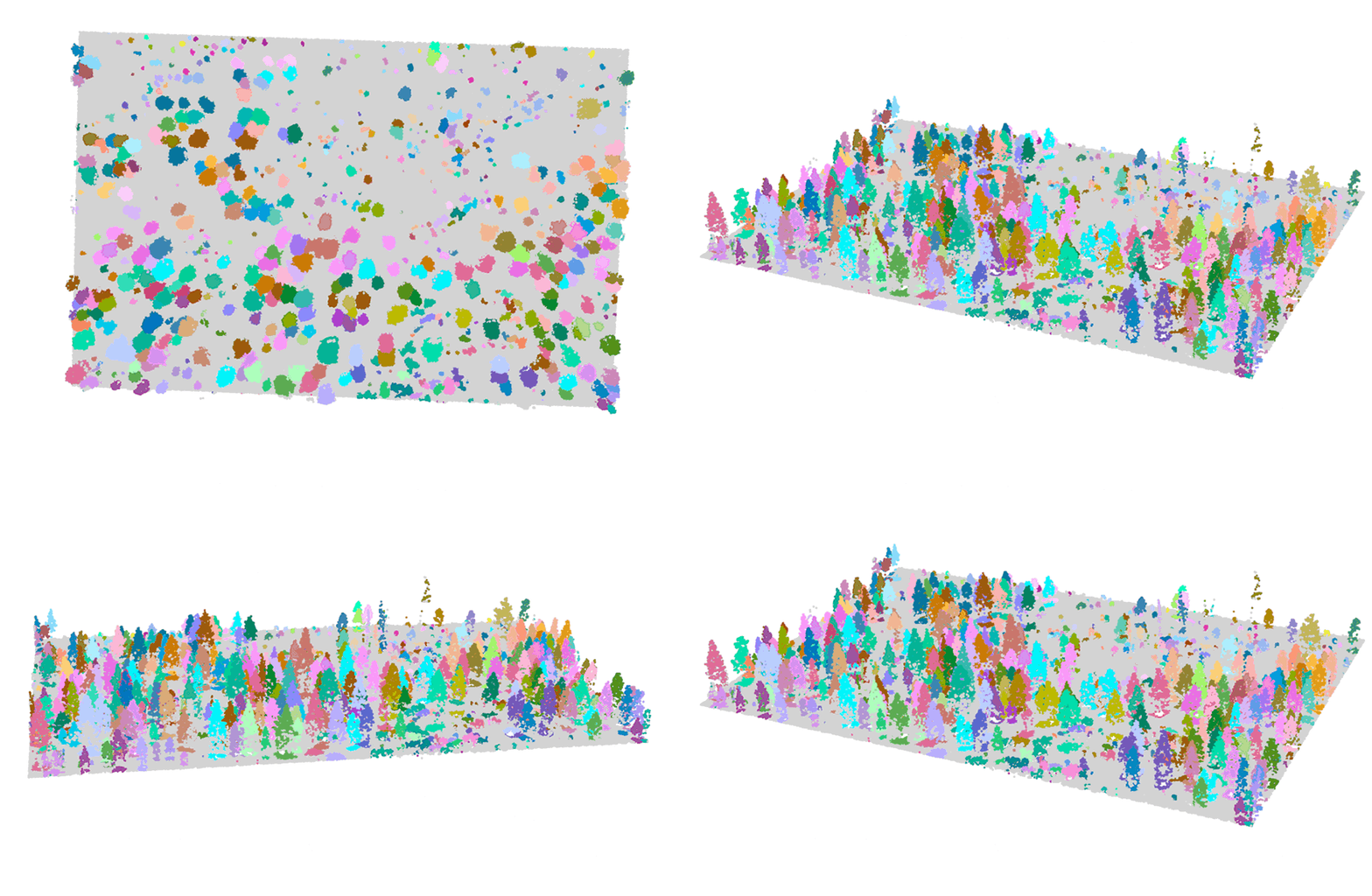
Understanding the effect of a fire relies on having a detailed map of the trees in an area. This includes the location of the trees as well as their type, size and spacing. The map also needs to be kept up-to-date.
We are helping Vibrant Planet create such a map for all the trees across the western United States. It is a phenomenal task.
The mapping draws on machine learning models to predict tree canopy height and shape based on aerial and satellite imagery and LiDAR (light detection and ranging) data. We use the canopy information to estimate various features of individual trees, such as their height and the shape of their crown. These predictions are validated against measurements made by ecologists in the forests.
Updating the map regularly allows natural and human-made changes to be incorporated. These include new roads, landslides and forest fires. We have developed a process for regularly updating the predictions to reflect recent changes in an environment.

Deforestation in tropical forests
Vibrant Planet is developing a tool that uses carbon incentives to help reduce the deforestation of tropical forests. Remote sensing data will be used to monitor these areas for potential deforestation.
Sassan Saatchi from NASA and the University of California, Los Angeles is an important collaborator in this work.
Project team
Edward Abraham, Fabian Döweler, Ignatius Menzies, Kiarie Ndegwa, Ian Reese, Sadhvi Selvaraj.
About Vibrant Planet
Vibrant Planet is a public benefit corporation based in Nevada. It is led by a team of climate policy leaders, scientists, foresters and tech leaders (from Netflix, FaceBook, Lyft and Guidewire). The Land Tender platform was built to inform and accelerate natural resource management and protection with the goal of keeping forests and other natural landscapes intact.
Top image: False colour images of identified trees before and after a fire.
We’re deeply grateful for our partnership and the incredible contribution of the Dragonfly team.
One of the big gaps in the land management space has been the lack of tree level data. This gap has resulted in slow planning, an inability to build robust, visual treatment scenarios for consensus-driven planning processes, and to integrate large scale finance prioritization with tree level decisions and implementation and monitoring. Our work with Dragonfly fills this critical gap at a critical time for the world’s forests, many of which are on the verge of catastrophic tipping points.
The good news is that this data, housed in our decision support, monitoring, and forest finance platform will speed and scale restorative and protective actions. Possibly in the nick of time.
Allison Wolff
CEO
Vibrant Planet .

