Frustrated with the limitations of current web mapping software, Dragonfly’s digital cartographer Ian Reese set about making something better. Now this new method is being rolled out to our clients.
Ian says he was irritated at being stuck using outdated and unsupported software to handle raster data. (Raster data is pixelated data where each pixel represents a specific geographical location.)
“In the last 10 years, web mapping software has moved on from stacked raster tiles to vector tiles. In this transition, the capabilities of handling multiple raster datasets in web mapping applications have been lost.”
“The real difficulty was the inability to work with quality scientific data, usually in raster format, and get it to the web in an aesthetically pleasing format. Current web mapping software and methods do not make that easy.”
Ian started looking into a solution during the 2020 lockdown. “I had time then to really dig into the problem, but there was a long series of roadblocks to get through.”
“Vector tiles are more efficient and certainly have a place in web mapping, but the need for integrating raster data has not diminished. The difficulty has been bringing vector and raster data together while effectively blending the two data types for use on the web.”
Ian says he looked at a lot of commercial web mapping software but couldn't find anything to replace the old method for creating raster tiles with blending capabilities. For a while he contemplated writing code to do it himself.
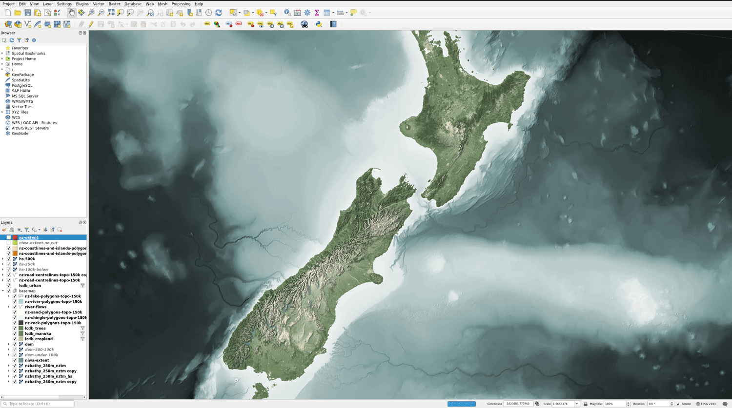
“Solving this problem was the hardest part of the project. In the end, I decided I didn't need to reinvent the wheel and looked to QGIS and GDAL to make it work. QGIS did most of what I needed in visualisation, setting zoom rules and blending data, and the Cloud Optimized GeoTIFF (COG) format looked like it could potentially replace the need for raster tiles. I just needed to devise a method to turn QGIS rules into a COG."
The next challenge was working the COG into a pseudo raster tile cache, similar to the old mbTile format.
“COGs are not really meant to act in this way and it was new territory for me. COGs were developed to take a single raster and prep them for the web by restructuring the internal format of the file.(The file is rebuilt internally with a tiled pyramid structure that looks like the old raster tile cache.)
“However, COGs work exceptionally well with aerial imagery, so my reasoning was that if COGs can handle RGB images, it shouldn’t matter what that image is, as long as it follows the method of the internal COG structure. I thought this approach had potential to solve the problem and save me a lot of time.”
Ian was able to use QGIS, PyQGIS and GDAL to wrap the method together. It exports a web-ready map with the specified features and zoom rules – conveniently as a COG. He says the method works surprisingly well, though there are still a few wrinkles to iron out.
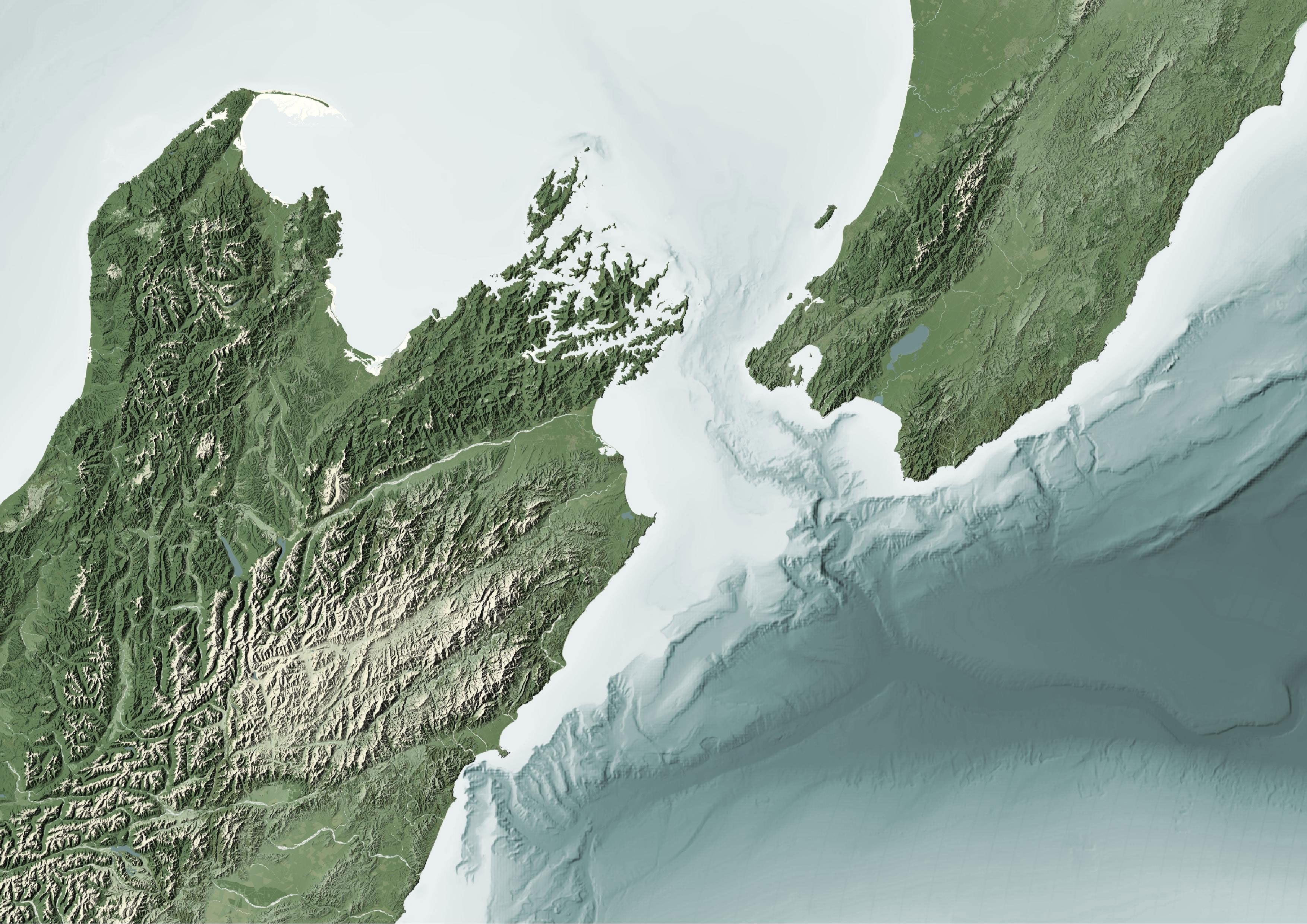
The result is a single raster file that displays all the built-in zoom rules. It works seamlessly on the web and with QGIS. Ian couldn't be happier with the results.
“We've already started to integrate this process into our workflows. It’s been especially helpful when we needed a basemap for the web or to pass around for our scientists. The method keeps the map consistent for all our users since they’re working the same base image.”
“There’s also no need for specialised software or methods to read the map. The GeoTIFF format is pretty universal in the geospatial community and most software can handle it.”
Ian presented this research at the Pacific Geospatial Conference in Fiji in November 2022. He is a member of the FOSS4G (free and open software for geospatial) community and invites others to work with him on improving the method.
More information