Dragonfly provided technical support to a workshop convened by the Western and Central Pacific Fisheries Commission (WCPFC) under the Common Oceans Tuna Project, which met in Hawaii recently. The group was considering which mitigation methods would be most effective at reducing bycatch for sea turtles, but lacked a reliable map of turtle abundance.
Phil Neubauer was part of the Dragonfly team who worked on the project. He attended the meeting to present a new map along with the methods used to create it.
“There was a feeling that the existing maps were not designed to show open ocean turtle hotspots, so the committee chose our Delphi survey tool to gather the opinion of experts from around the world and create something more fit for purpose,” he says.
Dragonfly’s online Delphi survey is an alternative to a workshop situation. Instead of sitting in a room together, experts contribute their knowledge anonymously online via a series of questions. After a first round, a summary of responses is given to the participants, who then repeat the survey. Statistical models of their answers are then used to produce a consensus view.
“Chris set up a virtual map of the Pacific Ocean, divided into a 5 x 5 degree latitude and longitude grid. Participants had to colour in the squares according to the density of turtles they thought were in that area. For the four turtle species, between 11 and 14 people took part, but with the diversity of answers we received, finding a consensus wasn’t trivial!”
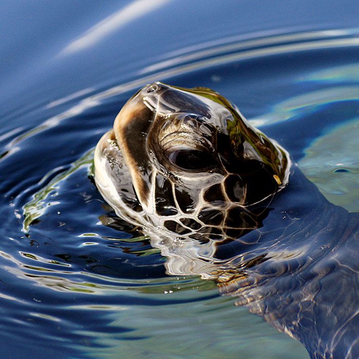
Turtles, like the tuna and billfish (swordfish and marlin) they are caught with, navigate incredible distances in the ocean. Knowing where the turtles are is important for both understanding the bycatch issue and for simulating different mitigation scenarios.
“A lot of the fisheries data was confidential so the mitigation models could only be run during the workshop. It was intense – the issues were talked through right then and there as they arose. The participants were a good mix of policy and science people, and we were guided by WCPFC Secretariat Shelley Clarke, who was amazing at keeping everyone focussed on the goal.”
For longline fisheries, mitigation methods include simple actions such as changing the type of bait or removing hooks that are close to floats – these are nearer the surface and therefore more likely to be attractive to turtles. The range of options (and their likely effectiveness) will now be taken forward to a discussion about what’s feasible for fishers.
“It was fantastic to be part of this. If any of the mitigation methods go through, ultimately it means that a lot of turtles won’t lose their lives in those fisheries. With even a minor increase in the mitigation methods, hundreds or thousands of turtles could be saved. If more extensive methods are adopted, it’s probably thousands to tens of thousands over the next few years. Knowing I’ve contributed something to that is really great.”
The Western and Central Pacific Fisheries Commission is the international organisation responsible for the management of high seas tuna fisheries and associated species. It has 26 member countries. The mapping work was supplied under contract to The Pacific Community (SPC), which provides science support for the WCPFC.
Read a summary of the turtle mitigation workshops on the website of the Common Oceans project or access a copy of the Dragonfly report for the SPC.